
This is a blog I have been meaning to write for some time. As a local, I often get asked, ‘What are the best hikes where you live?’ I will share my top 10 hikes close to Salt Lake City. All these hikes are located within the Central Wasatch Mountains, within an hour drive or less from anywhere in the Salt Lake Valley. We are definitely blessed to have such close access to nature.
A little background information: the Wasatch Range spans about 160 miles from the north to south, beginning just south of Soda Springs, Idaho, and following a buckling of 160 miles of jagged peaks, ultimately ending at the Wasatch Plateau near Gunnison, Utah. The range is considered the western terminus of the Greater Rocky Mountains, and to the west lies the Great Basin. The Wasatch Range is split into several smaller sub-ranges, including the Bear River Mountains near Logan, or the Wellsville Mountains in Box Elder County. The three sections of the Wasatch Mountains that create the bulk of the range, as well as the most easily accessed, are the Northern, Central, and Southern Wasatch Mountains. In this blog, I am focusing only on the Central Wasatch.
The hikes will be categorized by Lakes, Waterfalls, and Peaks. Each list will be ranked in order of my own level of perceived difficulty. Also note, that stats are never consistent, the stats I am using are based on my own personal data as well as AllTrails. Lastly, please follow all LNT principles when exploring our beautiful mountains!
Lakes
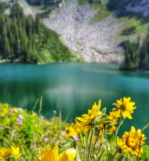
While the neighboring Uinta Mountains are known for their abundance of freshwater lakes, the Wasatch don’t quite live up to the reputation of the“1000 lakes” as the Uintas do. However, what the Wasatch lack in number, they more than make up for in terms of natural beauty. While there may only be a few dozen lakes in the Wasatch, each Lake is spectacular and worth a visit in it’s own right.
I will list 3 hikes, that in my opinion, provide the best the Central Wasatch have to offer in terms of lake hikes. As mentioned above, each of these hikes are less than an hour from anywhere in Salt Lake Valley. Note, there are backpacking opportunities at each of these lakes, as backpacking has grown in popularity recently. Once again, please follow all LNT principles if spending the night at one of these pristine lakes!
1. Brighton Lakes – 7.0 miles RT and 1800 feet of elevation gain/loss
This route is a shorter variation of the Brighton Ridge Traverse, without hiking any of the Peaks. On this route, you’ll hike up to Twin Lakes, traverse the old single track trail to Lake Mary and then climb up to Lake Martha, Catherine and Catherine’s Pass and back down. AllTrails has this route mapped out, and can be found here.

2. Redpine Lakes Stats: 8 miles and 2200 feet to Lower Redpine; 9 miles and 2750 feet to Upper Redpine.
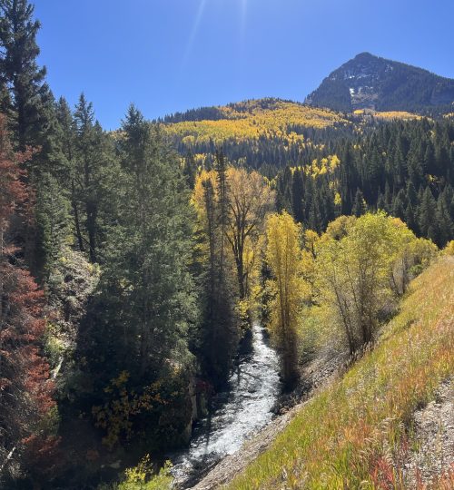
The hike to Redpine Lake starts at the White Pine Trailhead in Little Cottonwood Canyon (a little confusing!). but the White Pine TH is also the starting point for White Pine Lake as well as Maybird Lakes. Along the way to Redpine Lake, you’ll see a split to White Pine. After that split, there’s a smaller trail just past the bridge/stream crossing to Gloria Falls, nice detour but very popular. Continuing along Redpine, there’s a great overlook of Salt Lake Valley about 1.5 miles in. About 3 miles in, there’s another split to Maybird Gulch. Once you reach Lower Redpine Lake (the main lake), there is a trail/path up to 3 upper lakes! With how many variations there are on this trail, it’s possible to do numerous combinations of hikes. From Upper Redpine Lakes, there’s more advanced routes to several 11,000 summits as well!

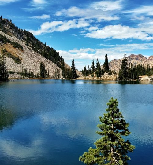


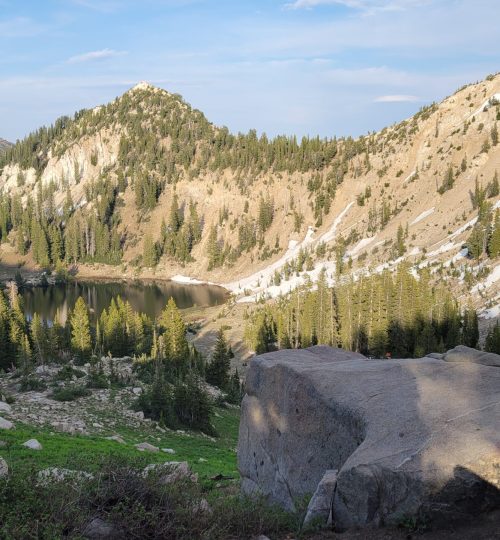
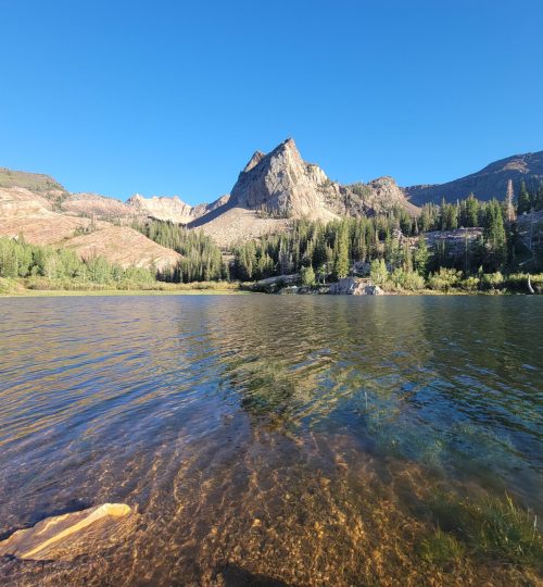
3. Lake Blanche: 7.0 miles and 2800 feet to Lake Blanche
Lake Blanche is the ultimate Wasatch postcard! The hike starts at the Mill B South Trailhead just below the S-curve in Big Cottonwood Canyon. The hike itself meanders up the beautiful canyon, making it’s way up to a glacial carved bowl beneath Sundial Peak. Give yourself time to walk down from Lake Blanche to two bonus lakes: Lake Florence and Lillian. There’s also trails meandering in multiple directions from the Lake and I feel as if there’s always something new to explore!


Peaks
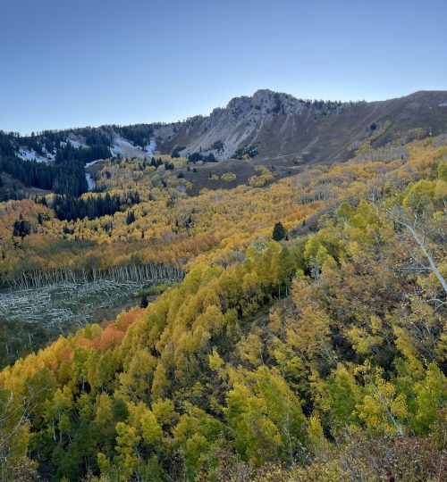
This is where the Wasatch shine pack quite the punch! With such easy access, there are dozens of summits, most of which have trails or well-known routes, that can be done as half-day or full-day hikes. There’s also many ridgelines that extend for miles, and for peak-baggers, this means you can easily summit multiple peaks in a single day. With a base of 4200 feet in the valley, the peaks range in elevation from a mere 5200 feet, to just shy of 12,000 on the southern end of the range, Mount Nebo, the official highpoint. The Wasatch are also known for their 11,000 foot summits; or “11’ers”. Depending on who you ask, there are between 20-30 Wasatch 11’ers. Some have enough topographic prominence to be considered true summits but some don’t. If you’re a peak bagger, checking off all the summits is rewarding challenge!
1. Sunset Peak Via Brighton – 6.0 miles RT and 2000 feet of elevation gain/loss via Brighton.
Beginning at Brighton Resort, my preferred route to Sunset Peak, you’ll pass Lake Mary, Martha and Catherine up to Catherine’s pass. From here, you’ll turn south and follow a well-traveled trail. At the next junction, you’ll turn east towards the final push to the summit .The AllTrail link can be found here.
This peak can also be summited from Alta Resort in Little Cottonwood Canyon but note that parking is harder to find, and you’ll pay $10 as well. This route is beautiful as well but you don’t get to hike past the lakes. This route is only 4 miles RT and 1322 feet.


2. Grandeur Peak via Church Fork 7 miles RT and 2300 feet (8 miles RT and 2600 feet if parking lot is full)
I find Grandeur best hiked between October to May. While the first mile of the hike is shaded, the rest is out in the open and very hot in the summer months. In the winter months, or on popular days, you’ll find yourself parking alongside the Millcreek Canyon road, near the gate for the Church Fork Picnic area, as the main trailhead parking is very small. You will have to hike through the picnic area, which is a treat in and of itself! During spring run-off, there are multiple waterfalls along the picnic road, and in the fall, the colors are spectacular! In the winter, the hike gets well-tracked out due to its popularity!


3. Gobblers Knob/Mount Raymond ~ 8 miles RT and 3100-3200 feet.
These are two of the highest peaks along Mount Olympus Ridge and like many of the hikes I have listed, they can be accessed from multiple trailheads. My preferred route is from the Butler’s Fork TH in Big Cottonwood Canyon. The two peaks share the same route until Baker’s Pass, which is about 3 miles in and sits at 9370 feet above sea level.
Gobbler’s Knob lies to the East and is just over ¾ miles and ~1000 feet from the pass (so steep!) but has a trail to the summit. Also, note that there is a false summit as well!
Mount Raymond lies directly West of Baker’s Pass and is similar stat-wise, about ¾ mile and 900 feet. However, Raymond requires some relatively easy scrambling, including a “knife’s edge” section, which is well-known to locals. I find the knife’s edge section to be a bit exaggerated, as the ridge isn’t super exposed and the scrambling is relatively easy.
Notes:
You can also hike both in one go! I have never done it but I’d imagine the stats are: 10 miles RT and 4100 feet.
The other route to Baker’s Pass is via Millcreek Canyon.
From Butler’s Fork, there’s is also a short/sweet walk to Circle-all-Peak, which is a small bump with spectacular views.
4. Pfeifferhorn – 10 miles RT and 3700 feet
If you’ve hiked Lower Redpine Lake and find yourself exploring the upper lakes, you may be interested to know that directly west of the lakes is a well-known route to one of the most popular 11’ers in the Wasatch! From the Upper Lakes, it is a mostly a scramble, Class 2-3, to the summit. The last few hundred feet are the steepest and loosest. In my opinion, Pfeifferhorn has some of the best 360 views of any Central Wasatch summit!
Waterfalls
Waterfalls! Who doesn’t love a picturesque waterfall? While the Wasatch aren’t necessarily known for an abundance of waterfalls (similar to the lakes), the few waterfalls we do have are spectacular and worth a visit!
1. Lisa Falls – 1/4 miles RT and 75 feet of elevation gain/loss
A few miles up Little Cottonwood Canyon, there’s an unmarked parking lot for Lisa Falls (the TH is marked on Google Maps). This is a very short little walk to a nice waterfall. In 2021, a series of avalanches took out a big section of the drainage of Lisa Falls, and re-directed the creek a little bit! In the winter, the Lisa Falls drainage is a known avalanche path.
If you’re feeling brave, it is possible to scramble above the main waterfall to a series of waterfalls! I have only done this once and the scrambling was tricky! Don’t recommend for inexperienced scramblers.
There are also many rock climbing routes as well as advanced mountaineering.
2. Donut Falls – 1.5 miles RT and 300 feet (4 miles RT and 500 feet in Winter)
If you’re from Utah, you have likely been here or you try to avoid it. Or you go in Winter. Regardless, Donut Falls is a spectacular waterfall but it is very crowded in the summer months. The trail starts at the Donut Falls TH in Big Cottonwood, however, in the off-season and crowded days, you may need to park at the Mill D North TH. The actual trailhead is on a 1 mile long, well-maintained dirt road. If you park at Mill D North, there has been a new trail developed, so please follow that rather than walking the residential road.
Also important to note, the waterfall itself sits in a box-style canyon, once you make it to the trail’s end, there is rock scrambling/hopping involved to get to the actual falls. So the “family-friendly” rating of this hike can be deceptive.
During high spring run-off (usually, May to Late June), the water can overflow over the donut-shaped ‘cave” where the falls sit, so it may not be possible to get into the falls, rather just see it from afar.
3. Bells Canyon Firstand Second Falls (5 miles RT and 1500 Feet to First Falls)
Ah yes, if there’s a waterfall that rivals Donut Falls in popularity, it’s Bells Canyon! In 2022, a new expanded Trailhead, called the “Bells Canyon Preservation Trailhead” was built specifically to access Bells Canyon, You can read about it here. In addition, the Granite TH still exists as well as the Boulder TH. My stats from the Granite TH, as I haven’t hiked the canyon since the new TH was built.
About 3/4 mile in, you’ll reach the Lower Bells Canyon Reservoir, which is a treat in of itself! There is a trail that circles the reservoir as well!
The last ¼ mile before the first falls is the steepest section of the hike!
The hike remains consistent and steep to the Second Falls! But the crowds thin out after the first falls. Second falls is also worth visiting! (unfortunately, I don’t have stats on the second falls). My best estimate is 6.3 miles RT and 2500 feet). Will update this later!


Bonus: Moss Ledge Waterfall (no trail): 0.5 miles RT and 310 feet.
This waterfall is relatively unknown and doesn’t have a trail. It is fairly short and requires scrambling the entire way. AllTrails now has a hike for it. But essentially, you follow the stream the entire way and you’ll a faint trail.
Years ago, there used to be a Picnic Area here. I remember spending time there with my family in 2009, not sure why it was taken down.


