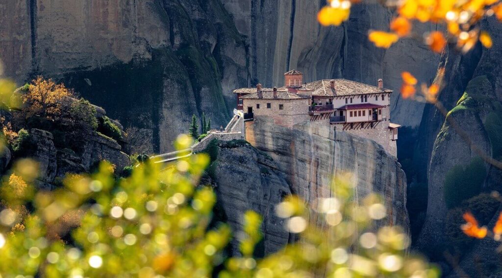
IG used to be, in a sense, a travel diary for me. In the simple days when a simple photo with a caption was the extent of which IG influenced people. Back when it was a small app, where people shared pictures of beautiful unfiltered nature and landscapes. Before photography became oversaturated with the same photo, same destination, same photo with a pretty girl in the same outfits. When the love of nature overpowered the need for clout.
First Aerial Tour Experience:
“I first wanted to do an aerial tour in August of 2018. The Denali aerial tour In Alaska. It was mean to be a graduation present to myself. The various tours were between $300-500 but the week before we went, there was a devastating accident. The first one in over a decade and all 5 passengers died. They couldn’t even recover the aircraft because it got quickly buried under snow. Then when we went, the weather was awful. A remnant of a cyclone was passing through the state and drenched us in rain for 4 days.
Last year, I had planned to do the Denali aerial tour once again. In July 2021. The day of the tour, I called and they said they were still running but I got spooked because of the weather and cancelled. I am not sure if it was the right decision. We could have flown still and maybe we would have seen Denali but it didn’t seem worth spending $400 to not see the full range. They still ran tours that day because we saw them from the Denali State Park overlook. So once again, I wasn’t able to do an aerial tour.
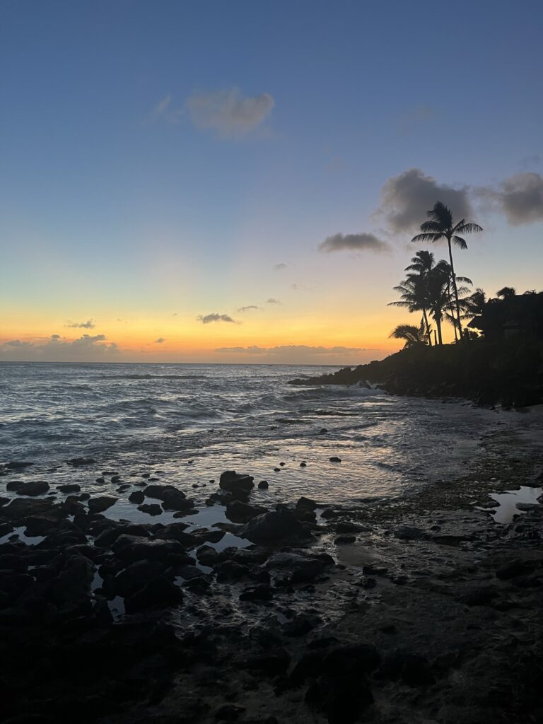
Later that year, before my breathing issues got worse, my brother offered me to come to Hawaii with him and I couldn’t get work off. He ended up doing an awesome Heli tour of the Napali Coast. When I go, I want to be under 225 lbs so I can do the doorless helicopter tour!
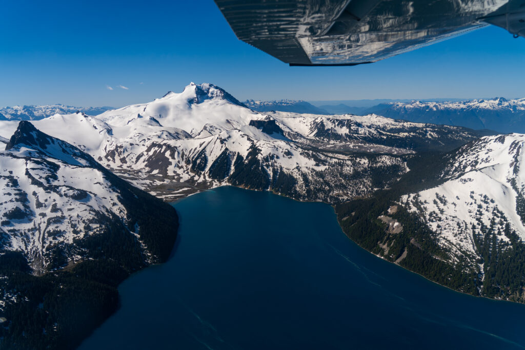
Suffice to say, I finally, finally got my first aerial tour this month in Canada (July 2022). I picked this 50 min tour specifically because it would fly over Garibaldi Lake. In 2019, I hiked up to Panorama ridge and got a cool, but cloudy view of the lake. This time, I got to see it in its full glory! Can’t wait for the next time.”
It’s just Water. Trees. Rocks. Plants.
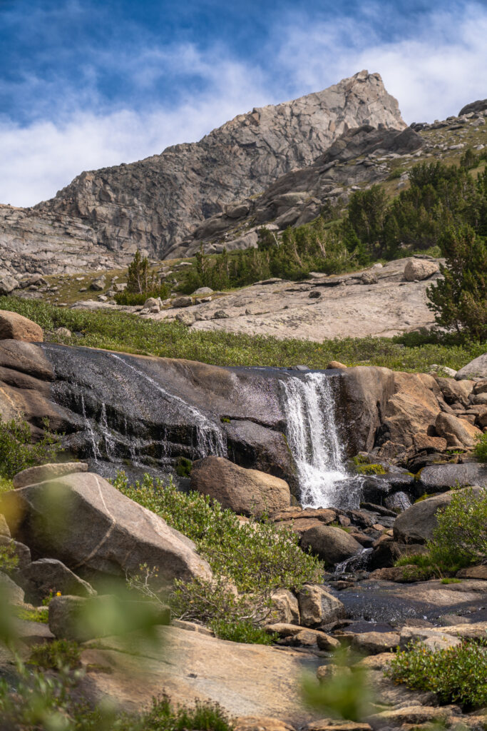
Water that carves the rocks into mountains and canyons. Whether it’s flowing or frozen. Every time I see a river or waterfall, I think of its persistence. It takes millions of years for the river to carve out the amazing canyons and mountains we see today.
When you walk through the Wind River Range, you’ll see millions of years of history preserved in stone. Millions of animal fossils. Rocks made of the pressurized sea shells remains that once lay at the bottom of the ocean, only to be lifted thousands of feet into the air.
They say the Rockies used to rival the Himalayas, towering 30,000 feet into the sky.
It’s just Water. Trees. Rocks. Plants.
If doesn’t amaze you, I don’t know what will.
Kauai – The oldest Island – about 5 million years old:
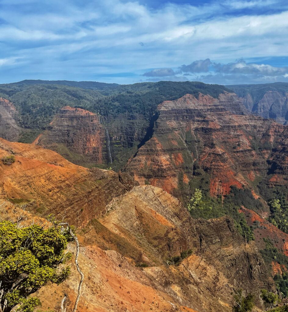
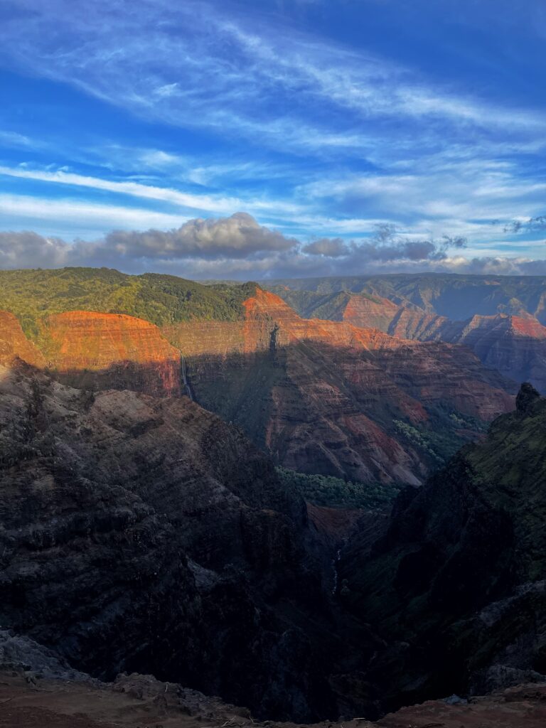
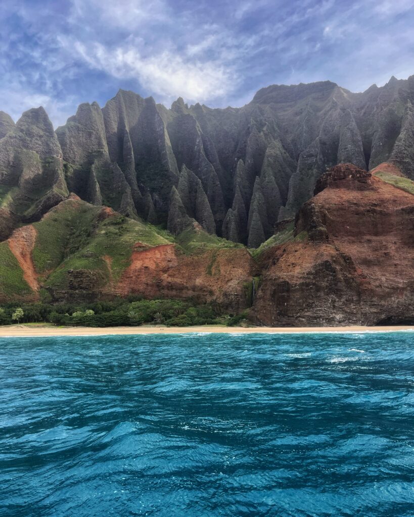
Being the oldest island has given Kauai the most time to erode by wind and water, which is why Kauai undoubtedly has the most epic scenery. From Waimea canyon to the second tallest sea cliffs along the Na’Pali coast (Top Picture) to Hanalei Bay. Kauai has many unique geographical features and for a nerd like me, it’s fascinating.
Many know Mauna Loa is currently erupting on the big island of Hawaii. What’s interesting is, that the reason Hawaii even exists is because of a mantle plume, and a hotspot. This hotspot creates pressurized magma chambers which send magma up towards the surface, and as it flows out of the volcanoes, the lava cools and over time, forms the islands. 5 millions year ago, the hotspot was under what is now Kauai. But the hotspot moves. Rather, the hotspot stays stationary, while the Pacific Plate moves Northwest as it subducts under the North American plate in the Pacific Northwest.
As the hotspot moves along, it creates more islands. The Big Island being the newest above water but also, scientists have found an younger island forming underwater, Southeast of the Big Island. In about 100,000 years, Hawaii could have a brand new island added to the existing chain!!
But wait, what’s even more fascinating is that the mantle plume causes the earths crust to bulge, and as the plate move the older Islands start to slip off the bulge. Once the Pacific Ocean was mapped, scientists found something absolutely amazing. A long chain of about 80 seamounts and underwater islands, with the oldest one being over 81 million years old, stretching all the way towards Russia. Scientists call it the Hawaiian-Emperor Seamount Chain.
Hawaii is geologists seeing the power of nature right before our eyes. It’s interesting to imagine what these old islands must have looked like. How many canyons, forests and peaks that no longer exist. So many things humans will never get to see because our life spans are so short compared to the age of our planet. And in a million years or so, Kauai will no longer exist either. But that still gives us humans plenty of time to go and appreciate the Garden Isle.
Waimea Canyon
Waimea Canyon is one of the more stunning features on the Island of Kauai! You wouldn’t picture a canyon like this on an island, as the common perception of a tropical island is palm trees and beaches.
So, how did Waimea canyon form? In one of my previous posts, I talked about how the Hawaiian islands formed from the gradual build up of lava from the volcanic hotspot. Well, imagine a dome shaped volcano (much like how Mauna Loa, Mauna Kea look like today on the Big Island of Hawaii). 4 million years ago, part of the dome collapsed and created a depression, which then filled with lava flows. Over time, the Waimea River began carving into the depression. Like a sculptor chiseling away at a rock piece. 4 million years of erosion later, you have the breathtaking Waimea Canyon.
This canyon is being carved out by the Waimea River, which owes its source or (headwaters) to Mount Waiʻaleʻale, which is widely considered one of the wettest spots on Earth (and with some nuance, the wettest spot on all the Hawaiian islands). It averages nearly 400 inches of rain a year, with the wettest recorded year in 1982 of about 683 inches of water! Unsurprisingly, Mount Wai’ale’ale is a shield volcano, like Mauna Loa on the Big Island but with the hotspot no longer under it, it is not active. The name means “rippling water” or “overflowing water” in the native Hawai’ian language. The rain that pours onto the summit of the mountain then flows off 3000 foot cliffs in spectacular waterfalls (I hope to see these next time when I do the doorless helicopter tour). It is one of the most stunning displays on Earth and one of these waterfalls becomes the Waimea River.
Waimea means “reddish water” in Hawaiian, which is due to the erosion of the red rocks in the canyon as the water carries them down. Because of the large rainfall, there is a substantial amount of erosion. Over time, as the basalt rock has been exposed to the elements, it has changed from the black rock we normally see, to a bright red. This gives the canyon a very unique look.